Gov. Scott Walker announced Monday that he’s asking the Federal Emergency Management Agency to conduct a preliminary damage assessment from flooding in northern Wisconsin. Last week’s storm and flooding has caused an estimated $30 million in damage so far.
Wisconsin Emergency Management spokesman Tod Pritchard said a federal assessment is the first step in getting a presidential disaster declaration.
“It’s going to be really important that we make sure everyone’s on the same page and we get all of the numbers in agreement with all the different agencies,” he said. “That will help Gov. Walker determine if Wisconsin should request that federal disaster declaration.”
Stay informed on the latest news
Sign up for WPR’s email newsletter.
A declaration would make federal funds available for road repairs. The National Guard is dispatched eight teams of engineers on Monday to help assess and repair damage to roads.
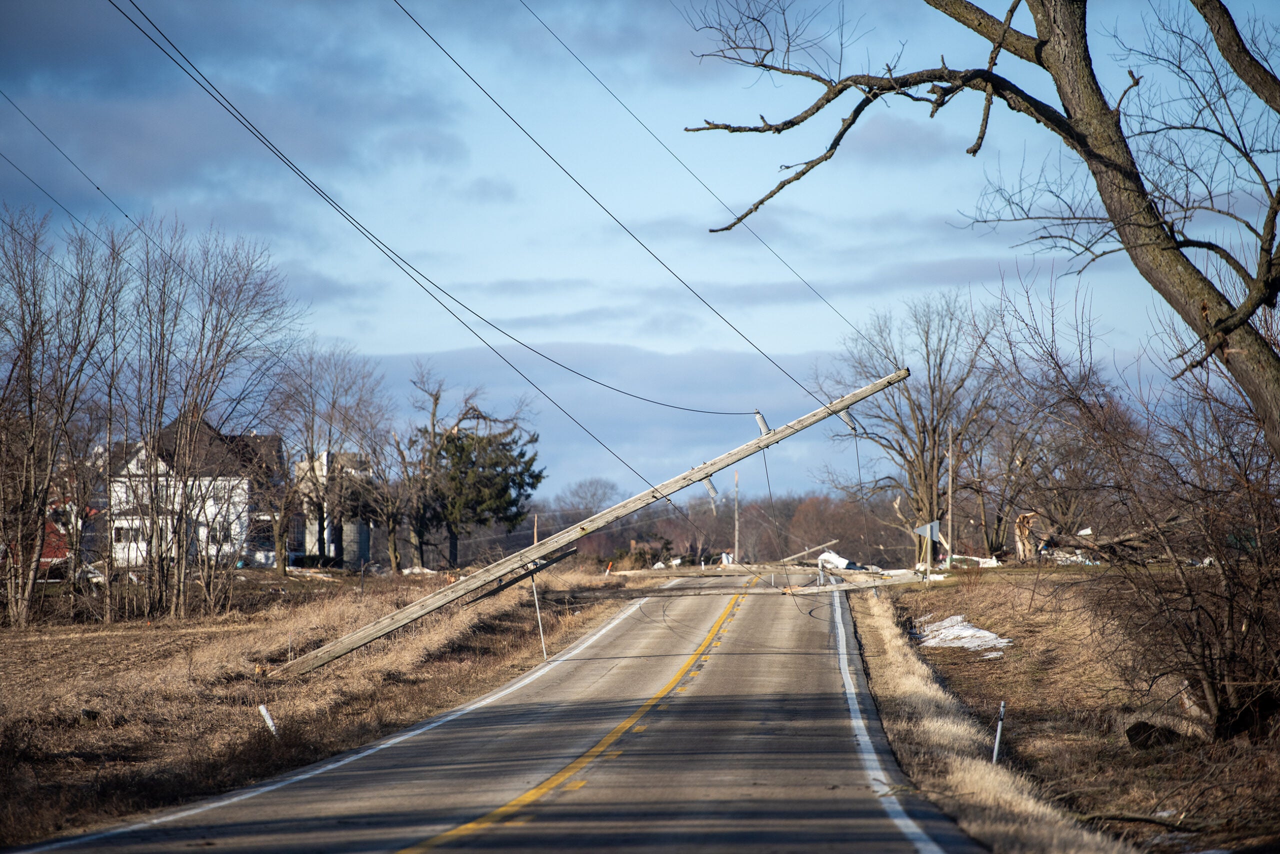
On Monday, the Wisconsin Department of Transportation announced it would be receiving $2.5 million in federal emergency funding from the Federal Highway Administration. The money will go to address an estimated $10 million in damage to state and federal highways. As of Monday evening, at least five state and federal highways in three counties remained closed.
According to Department of Administration Secretary Scott Neitzel, roads and other infrastructure represent the vast majority of the damage costs.
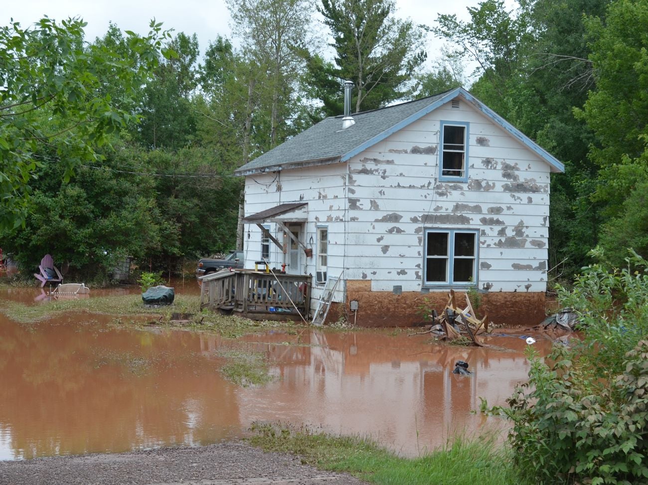
“Right now, what we’re looking at is … almost $29 million in pub infrastructure costs and just $1 million or $2 million in damages to homes and businesses in the area, and that’s as of today,” he said.
WEM’s Pritchard said the Wisconsin State Patrol is adding more officers to patrol along U.S. Highway 2 after a section of the highway was reopened to a single lane to accommodate light car and truck traffic.
“Obviously, there’s some parts of the roads that still have some loose gravel and not only Highway 2, but other highways in the area,” he said. “These roads are kind of being temporarily patched up or getting into decent driving shape, but it’s not clear, smooth sailing that you can even go at the posted speed limit in some places. That’s not applicable at this point.”
The Ashland County Sheriff’s Office posted on Facebook that larger vehicles should take posted detours where a section of U.S. Highway 2 reopened over the weekend:
“The detour is intended for locals that are getting to and from work, and emergency response vehicles. If you are recreating in the area, PLEASE take the long way around. I know this is inconvenient, but it is necessary to not cause additional work for our already-overworked road crews.”
Still, Neitzel of the DOA said U.S. 2 is expected to be fully functional by the end of the week.
Ashland County Highway Commissioner Emmer Shields said crews have been working 16-hour days on repairs. He said they’re having some trouble with traffic on town roads that weren’t engineered to sustain heavy traffic. He noted people have also been ignoring road signs.
“What we have behind our road closed signs is 8-, 10-foot deep trenches all the way across the highways,” he said. “You drive into one of those, and you’re going to be seriously injured or killed.”
The Bayfield County Sheriff’s Office reported one woman died Monday after she drove past road barricades and into a section of washed out road near Grand View, landing about 50 feet down from U.S. Highway 63. The victim’s name is not being released pending notification of family members.
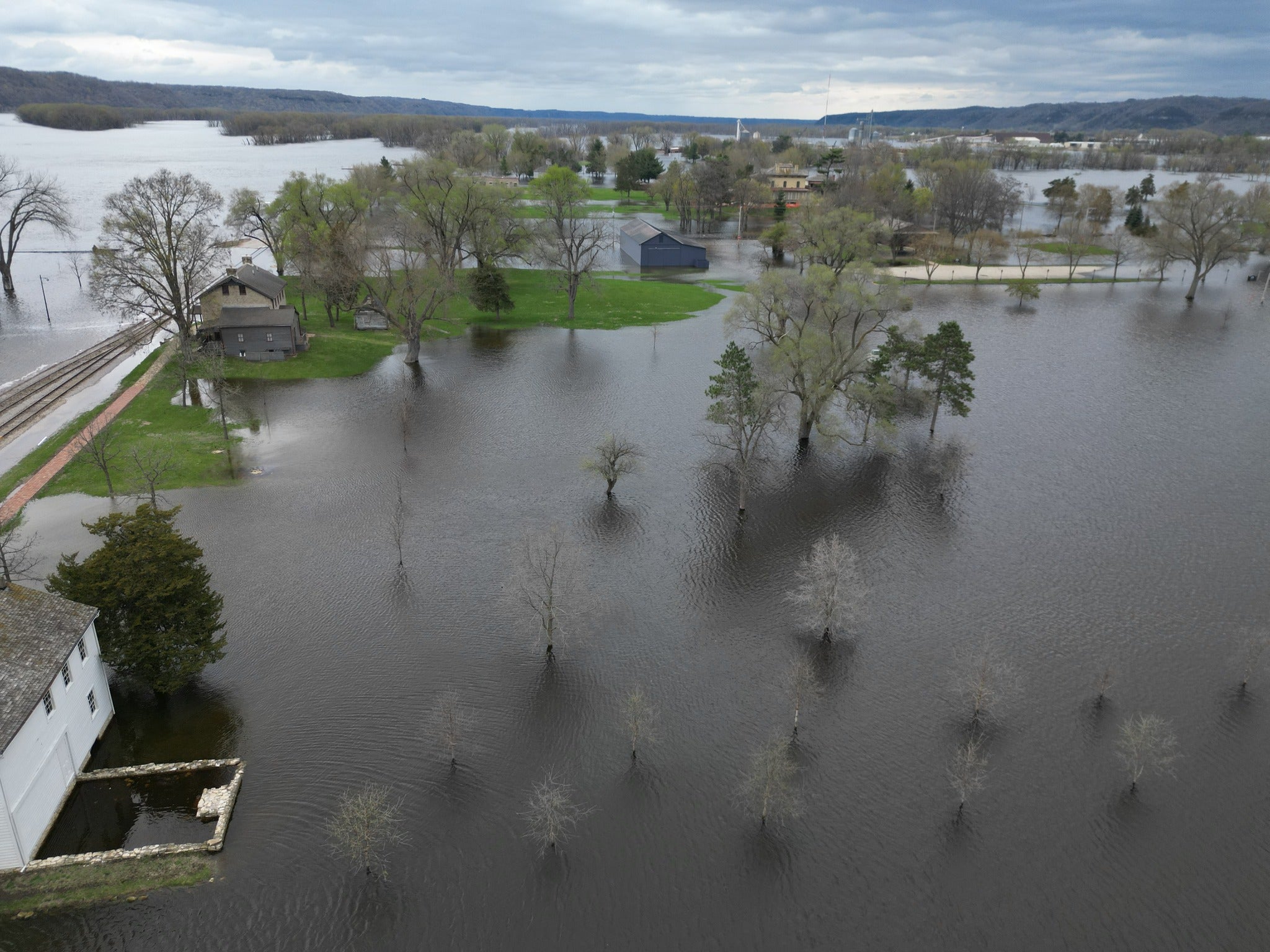
According DOA Secretary Neitzel, one factor making the flooding so severe was that the soil in northern Wisconsin isn’t suited for absorbing the amount of rainfall seen last week.
“We have a number of small streams that have an amount of water flowing through them that you really can’t imagine,” Neitzel said. “If you look at some of the readings that the Department of Natural Resources had on their flowmeters, they showed us that one stream went from 400 cubic feet per second to over 7,000 cubic feet per second, in just a matter of minutes.”
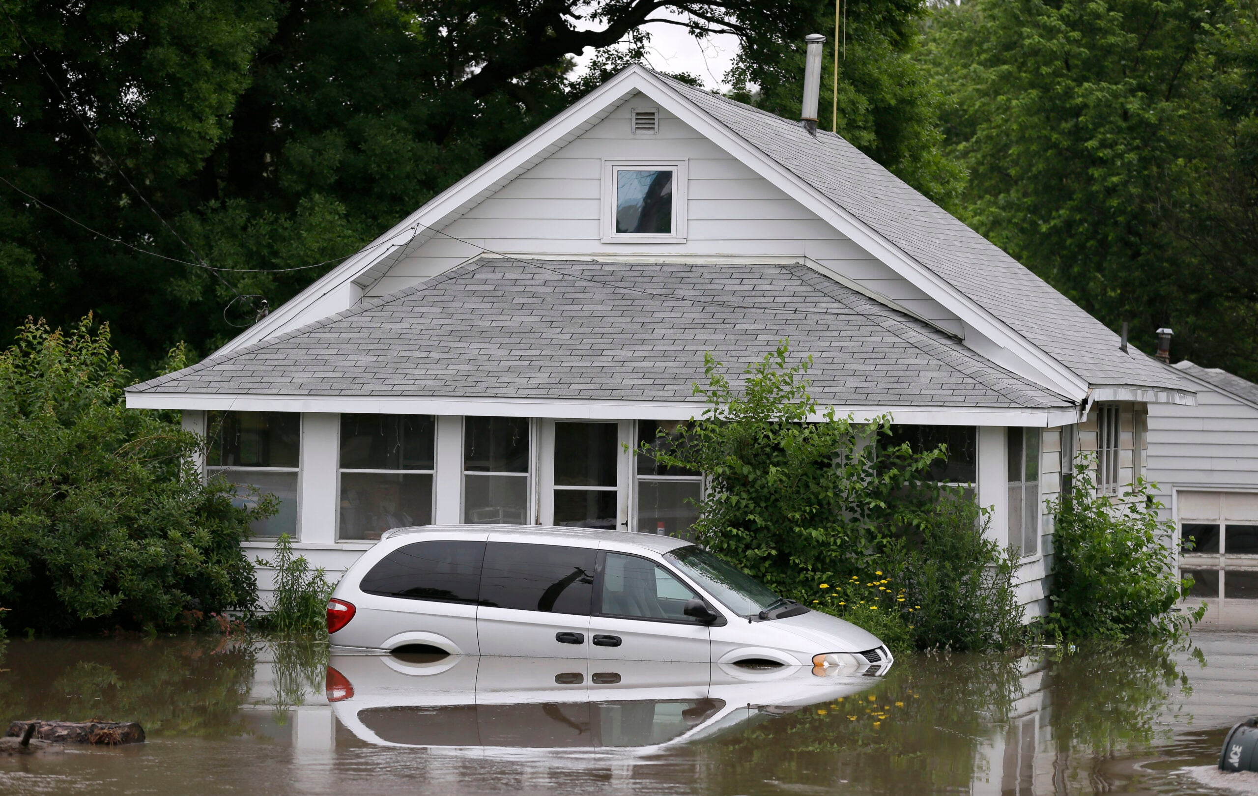
That surging water left at least 280 homes and businesses damaged by the flooding, the bulk of which are in Ashland and Sawyer counties. Bad River Band Flood Command spokesman Dylan Jennings said at least 10 homes were destroyed on the reservation. Some tribal members have been staying at the tribe’s casino and lodge.
“People are coming together and helping each other,” Jennings said. “Even if it’s just a hug or good thoughts and good prayers sent our way, people are really coming together and helping in that way to help restore hope for everybody, especially those ones that have lost everything.”
Jennings said it’s still unknown how the tribe’s wild rice crop is doing after the flooding. But, he noted the tribe’s subsistence culture of hunting, fishing and gathering has been affected by road closures and flood damage.
The Red Cross is providing meals to flood victims at the Bad River Community Center daily through July 22. A boil water notice remains in effect for the tribe, as well as advisories to avoid swimming in nearby waters.
In Iron County, damage exceeds $11 million after flooding ripped through Saxon Harbor’s marina and campground. A dive team will head out on Tuesday to search for two boats and two vehicles that have not yet been recovered.
Funds and hotlines are being set up in several communities to help with disaster relief in addition to donation sites for food and other necessities.
Road closures from the Wisconsin Department of Transportation:
Ashland County
- U.S. 2 is closed east of Odanah at Kakagon River. Use local route via River Road, Old U.S. 2 and Kakagon Road. No semi-truck traffic allowed onto local detour.
- WIS 13 corridor is closed between Mellen and WIS 112. Use WIS 77, U.S. 63, U.S. 53 and U.S. 2 as alternative route.
Bayfield County
- U.S. 63 is closed at Twentymile Creek near Grand View, north of Drummond. Traffic detoured via County Highway N and County Highway A.
Iron County
- WIS 122 closed north of U.S. 2 to Michigan State Line. No official detour posted.
- WIS 169 is closed between WIS 13 and U.S. 2. No official detour posted.
Wisconsin Public Radio, © Copyright 2024, Board of Regents of the University of Wisconsin System and Wisconsin Educational Communications Board.