It isn’t easy measuring snow when the flakes have been horizontal for more than a day. Rick Olivo is a “yellow stick guy” for the National Weather Service (NWS) in Ashland. He says some areas are bare.
“And there are other areas that are three feet deep. So I look for an average-looking area and stick my little stick in the ground, and that’s what it is.”
Stay informed on the latest news
Sign up for WPR’s email newsletter.
What it is, in Ashland, is five inches. The NWS’s Carol Christenson says this dose of winter in spring comes from a big, deep, strong system stacked to the upper atmosphere. It has covered lots of ground, and has stuck around.
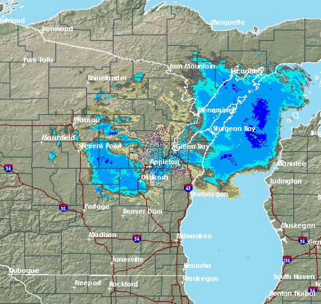
Finding clear skies today will take some doing.
“It is snowing in Siren. Not Rice Lake. You have to pretty far. I would say Eau Claire maybe, or maybe even – well, no, I see La Crosse has some snow too. Maybe Rockford, Illinois?
Meanwhile, she says they are getting ready for another spring winter storm expected Sunday.
Wisconsin Public Radio, © Copyright 2024, Board of Regents of the University of Wisconsin System and Wisconsin Educational Communications Board.