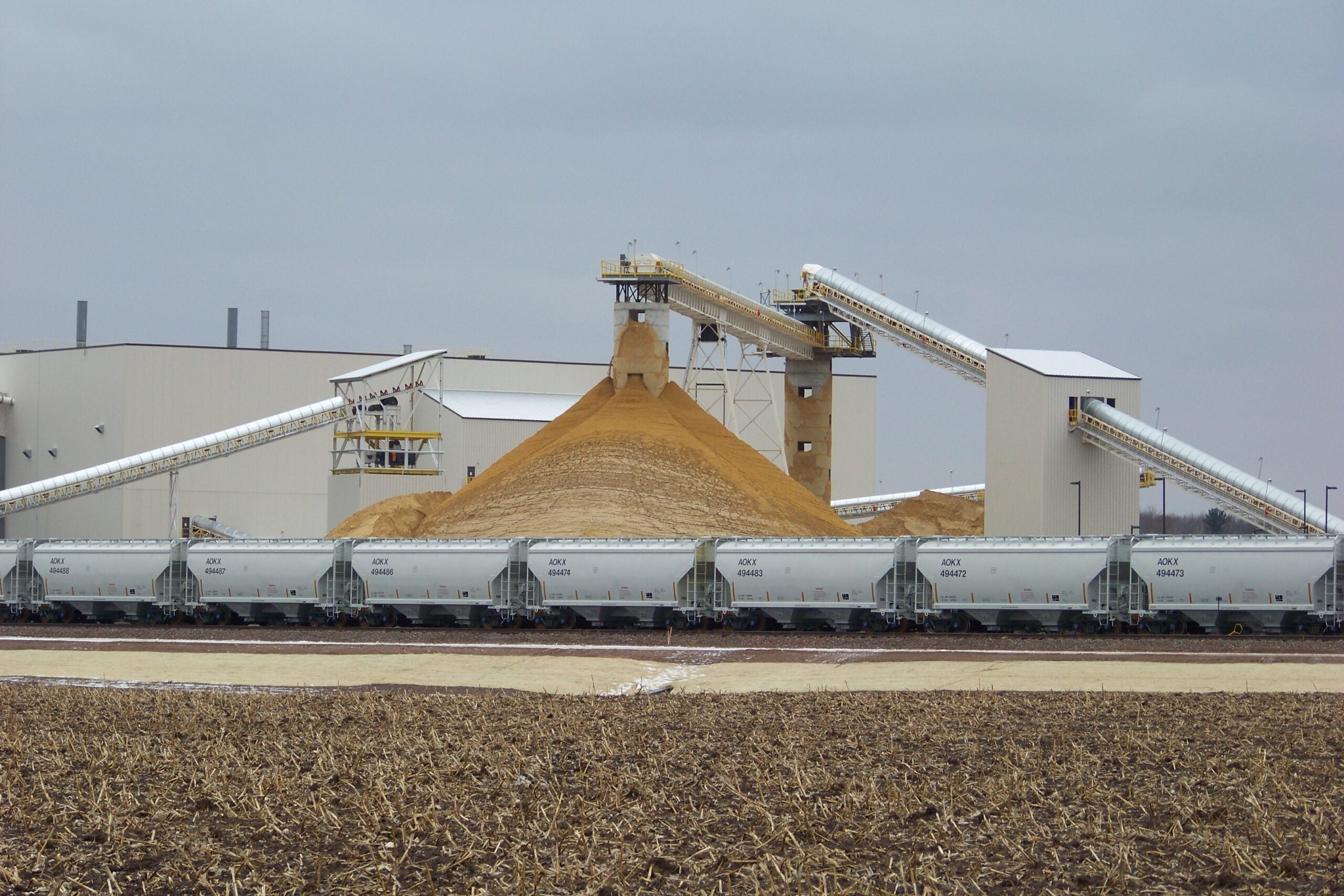
People who are curious about the frac sand industry in Wisconsin have a new tool to measure its growth: an interactive map created by the Department of Natural Resources.
It’s been nearly five years since frac sand mining really took off in the western half of the state. Only now has an official, up-to-date account of the industry’s footprint become available to the public.
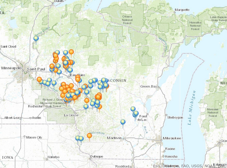
The DNR’s new web page includes a breakdown of sand mines, processing centers and rail loading facilities in the state, along with an interactive map with information about the companies doing the mining.
Stay informed on the latest news
Sign up for WPR’s email newsletter.
DNR frac sand mining expert Deb Dix said she had to compile data from three different DNR sections along with permits from 20 counties.
“All those pieces had never really been brought together before,” said Dix. “What I found when I started into this position, when I would look at the different databases and maps that were out there, there was duplication.”
That duplication was troubling, said Dix, because anxieties were already running high due to how fast the frac sand industry was growing. Now, she said new and accurate data will be available every quarter.
“It’s kind of taken me a year just to clear everything up and get all of the data where I wanted it to be and just to get everything nailed down,” Dix said. “So, hopefully this is going to be a really accurate — or as accurate as possible — updated database.”
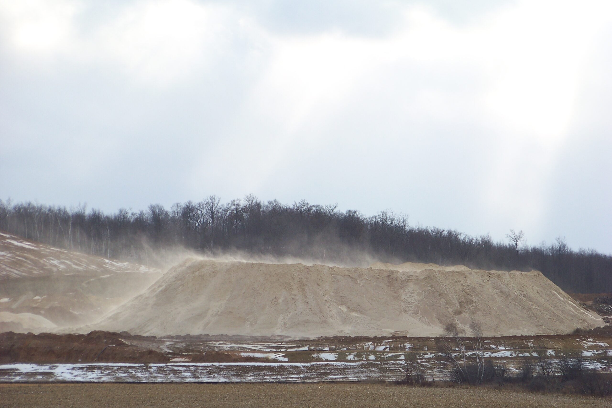
Dix said she made the map after getting numerous calls from real estate developers curious about where mines were and from investors looking to get in the game. According to the DNR, there were 135 active frac sand facilities and 94 more inactive sites as of May 1.

Wisconsin Public Radio, © Copyright 2025, Board of Regents of the University of Wisconsin System and Wisconsin Educational Communications Board.