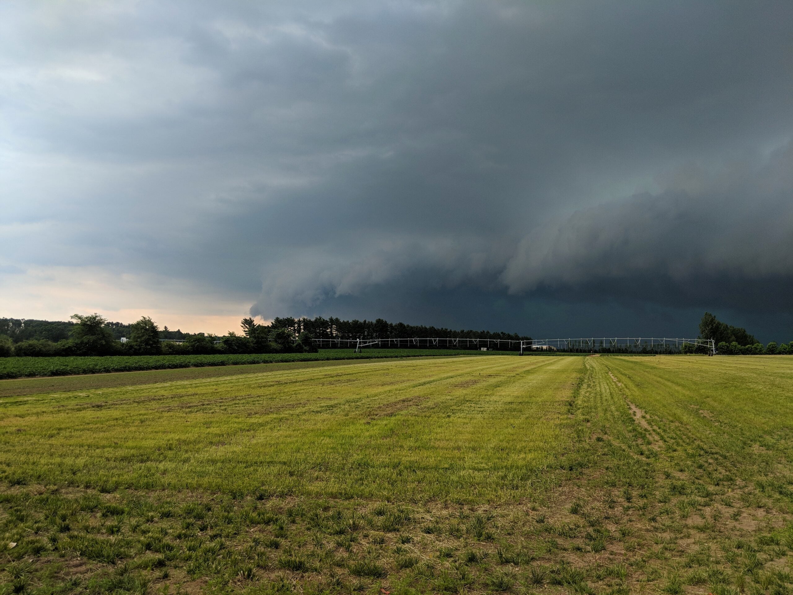
Tornado season in Wisconsin started early this year and still rages on as the state enters the peak time of the calendar for severe weather.
According to the National Weather Service, Wisconsin saw 39 confirmed tornadoes through the first six months of 2024, including the state’s first recorded tornadoes in the month of February.
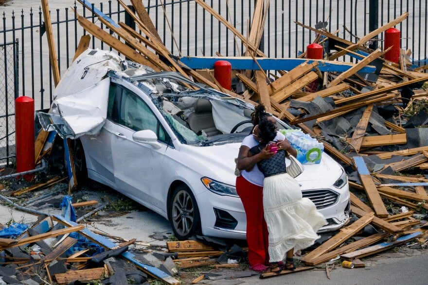
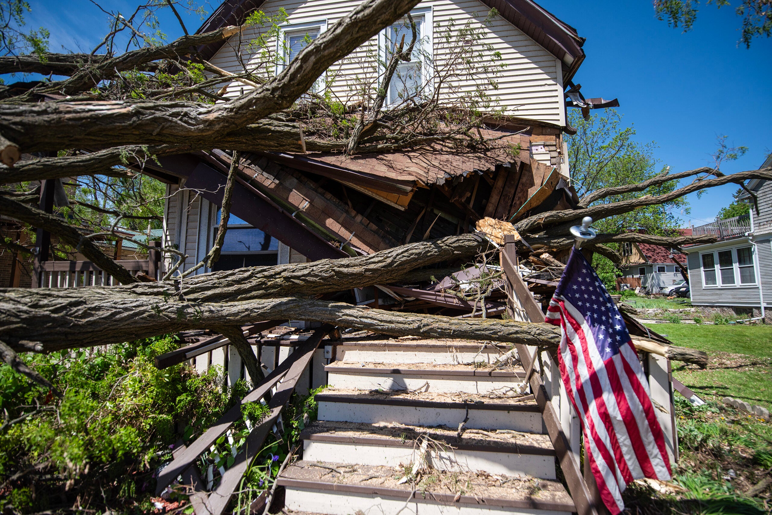
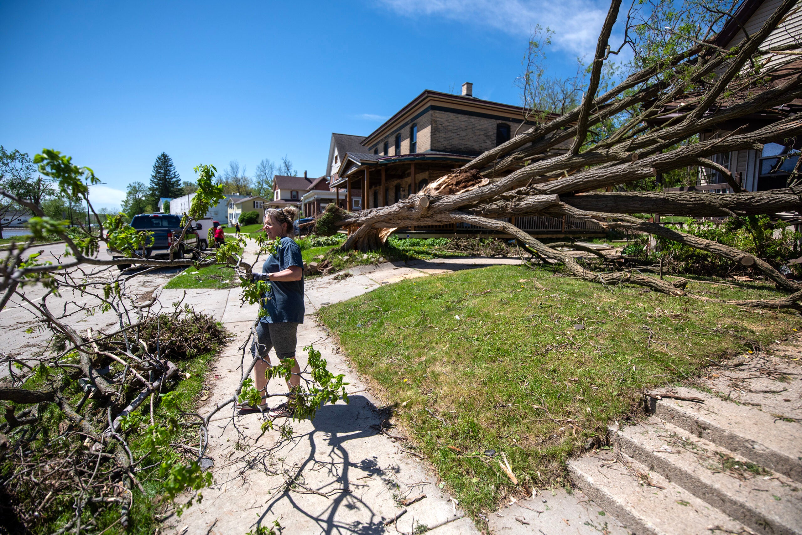
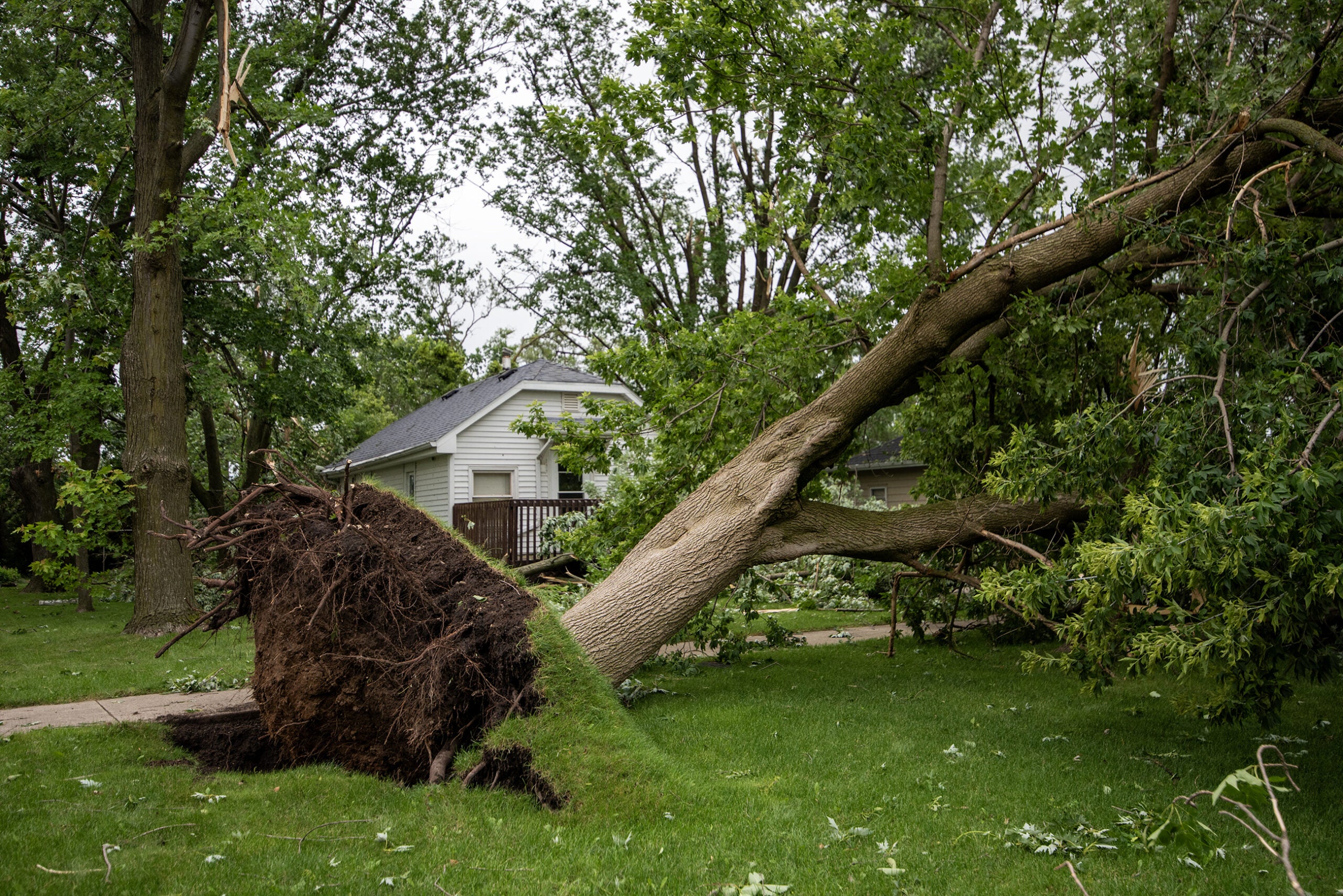
No deaths have been reported from these storms, but three of the stronger EF-2 tornadoes — storms with speeds from 111–135 mph — that hit southern Wisconsin caused significant property damage.
News with a little more humanity
WPR’s “Wisconsin Today” newsletter keeps you connected to the state you love without feeling overwhelmed. No paywall. No agenda. No corporate filter.
Warning coordination meteorologist Tim Halbach from the National Weather Service’s Milwaukee/Sullivan office said it’s been a more active year than normal for tornadoes in Wisconsin, which highlights the importance of severe weather safety procedures.
He spoke to WPR’s “Wisconsin Today” about what the state has faced so far and what could be in store for the rest of the year.
The following was edited for clarity and brevity.
Kate Archer Kent: Can you give us some historical context for just how many tornadoes Wisconsin has seen so far this year?
Tim Halbach: On average, the whole state of Wisconsin has about 23 documented tornadoes that occur each year, and for this year, we reached that by the end of May. Our peak tornado season is normally June and July, when we tend to see the most tornadoes, so we reached that average already before we even hit the peak.
As far as some of the other historical years in terms of the most tornadoes, the 2005 season is the highest. That’s when we had 62 tornadoes that occurred. But in the past few years, we’ve had some seasons where we’ve hit 40 or more tornadoes. In 2021, we had 41. And then also back in 2010, it was a year where we had 46 tornadoes.
KAK: Is it natural to have some of these fluctuations throughout the year? Does a heavy start of the tornado season mean we should expect to see even more as the year goes on?
TH: So some years, like last year, we had tornadoes occur early on. We had a severe weather outbreak that occurred at the end of March there, and that got a lot of people thinking “Oh, man, this is gonna be a bad year.” Well, everything kind of shut down after that, and we were in a drought basically the rest of the year. So every year is a little bit different.
When we talk about what’s normal and what’s not normal, it’s normal to be up and down and all over the place. Every year, we know we’re going to have some kind of chance for severe weather and tornadoes. That’s why we always talk about preparedness, what kind of things you need to do with being safe.
KAK: What is your view on the connections between climate change and the strength of these severe storms?
TH: If you talk with any of the climatologists and those involved with climate research, it’s about having a larger window for when these severe weather environments could potentially occur. So if you have longer winters, that window is a little bit shorter. If you have shorter winters, then our climate is going to be a little bit more conducive to having more severe events in the spring or even going later into the fall.
That’s one of the things we look at for us at the local level, forecasting day to day. We tend to focus more on what happens today through the next seven days, and we don’t get to spend as much time digging into the research. But when we’re dealing with years like this, obviously you get kind of concerned that, is this the new norm? When, over the past 20 years, things haven’t been quite as active.

Wisconsin Public Radio, © Copyright 2025, Board of Regents of the University of Wisconsin System and Wisconsin Educational Communications Board.