It might be hard to imagine Wisconsin without its lush foliage, scampering rodents and forest grazers, but the land contained within its borders was once something else entirely.
Barren. Hot. Volcanic.
Stay informed on the latest news
Sign up for WPR’s email newsletter.
Of course, that was about 1.8 billion years ago, and pretty much everything has changed since then.
Geologists who study Wisconsin’s landscape say there’s abundant evidence of the state’s rocky history. For example, in the Wausau area in central Wisconsin, loads of igneous rock prove there were volcanoes there. Another big clue? Rib Mountain.
But is Rib Mountain itself actually volcanic in origin? Mark Janowiak from New Glarus wondered about that, so he wrote to WPR’s WHYsconsin for some clarity.
“I’m a Wikipedia expert on Rib Mountain, so I learned three things about it,” he said facetiously.
In short, no. Rib Mountain is not and has never been volcanic. However, we’ve got Wausau’s volcanoes to thank for Rib Mountain’s existence.
Volcanoes existed in Wisconsin during the Proterozoic Record, well before dinosaurs roamed the land and even before there was any vegetation. These volcanoes were active, situated on top of magma chambers where magma is stored before it explodes out of volcanoes and becomes lava.
Eventually, a type of magma called syenite below one of these volcanoes buoyed up big chunks of quartzite that had settled there millions of years earlier.
Quartzite is a tough rock, explained Keith Montgomery, retired professor of geography and geology at the University of Wisconsin-Stevens Point at Wausau. It’s one of Earth’s hardest rocks, in fact. Because the compositions of the volcanoes weren’t as tough, they eroded away quickly. As erosion tore down the volcanic mountains, it exposed the hard quartzite rock.
The largest of these quartzite chunks is now known as Rib Mountain. Two others are Hardwood Hill and Mosinee Hill.
“People say that the quartzite of Rib Mountain was pushed upwards,” Montgomery said. “It wasn’t. It was almost the opposite that happened. It was sitting there, and it’s a survivor of the down-wearing of the landscape.”
So, about those volcanoes.
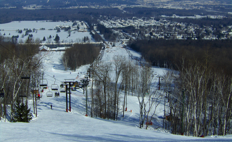
Janowiak’s interest in Rib Mountain began years ago. Visiting the ski hill there, renamed Granite Peak Ski Area in 2000, was a favorite winter activity for Janowiak’s family, who lived near Merrill.
“We skied a little north of Merrill, but for a rare treat, we’d go to Rib Mountain,” he said. “And that was like the Rocky Mountains for us.”
In learning that Rib Mountain’s history is tied to volcanoes, Janowiak wanted to know more.
“How big were the volcanoes when they formed a billion years ago? Was it like Mount Everest? How high were they?” he asked.
First of all, it’s important to keep in mind that Wisconsin wasn’t located in its current position. During this time — the equivalent to 18 million centuries ago — the North American continent was south of the equator in a rocky, sandy environment.
The volcanoes there were much like the Cascade Mountains and Mount St. Helens, likely in the realm of 10,000 feet above the local terrain, said Lisa Siewert, senior lecturer of geography and geology at UW-Stevens Point.
“Those are big, tall volcanoes called stratovolcanoes,” Siewert said. “They’re really explosive. They’re exciting.”
For comparison, Rib Mountain is about 650 feet above the local terrain, and 1,920 feet above sea level.
One-point-eight billion years ago, there were four of these stratovolcanoes in what is now the Wausau area. They were part of a vast range called the Penokean mountains, said Scott Spoolman. He’s a science writer based in Madison whose most recent books include “Wisconsin Rocks! A Guide to Geologic Sites in the Badger State” and “Wisconsin State Parks: Extraordinary Stories of Geology and Natural History.”
That mountain range, which spanned present-day Minnesota, Wisconsin and Michigan, started forming more than 2 billion years ago when two ancient plates collided in a phenomenon known as plate tectonics, a geologic theory for the existence of mountains, volcanoes and earthquakes.
Unlike the Penokean Mountains — which were long gone by the time the North American continent shifted north 10 million years ago — Rib Mountain’s quartzite has stood the test of time.
[[{“fid”:”1530241″,”view_mode”:”full_width”,”fields”:{“format”:”full_width”,”alignment”:””,”field_image_caption[und][0][value]”:”%3Cp%3ERib%20Mountain%20viewed%20from%20the%20north%20on%20Stewart%20Avenue%20in%20Wausau.%20%3Cem%3ELiz%20Dohms-Harter%2FWPR%3C%2Fem%3E%3C%2Fp%3E%0A”,”field_image_caption[und][0][format]”:”full_html”,”field_file_image_alt_text[und][0][value]”:”Rib Mountain viewed from the north on Stewart Avenue in Wausau”,”field_file_image_title_text[und][0][value]”:”Rib Mountain viewed from the north on Stewart Avenue in Wausau”},”type”:”media”,”field_deltas”:{“3”:{“format”:”full_width”,”alignment”:””,”field_image_caption[und][0][value]”:”%3Cp%3ERib%20Mountain%20viewed%20from%20the%20north%20on%20Stewart%20Avenue%20in%20Wausau.%20%3Cem%3ELiz%20Dohms-Harter%2FWPR%3C%2Fem%3E%3C%2Fp%3E%0A”,”field_image_caption[und][0][format]”:”full_html”,”field_file_image_alt_text[und][0][value]”:”Rib Mountain viewed from the north on Stewart Avenue in Wausau”,”field_file_image_title_text[und][0][value]”:”Rib Mountain viewed from the north on Stewart Avenue in Wausau”}},”link_text”:false,”attributes”:{“alt”:”Rib Mountain viewed from the north on Stewart Avenue in Wausau”,”title”:”Rib Mountain viewed from the north on Stewart Avenue in Wausau”,”class”:”media-element file-full-width”,”data-delta”:”3″}}]]
Quartzite is sandstone that’s been put through immense heat and pressure. The sandstone faced that kind of heat and pressure when it was buried — which could have been when the plates collided to form the Penokean range, Montgomery said.
The sand grains that make up the sandstone are even older — think 2.2 to 2.5 billion years ago. Those grains were buried and fused together to form the sandstone.
Glaciers And Rib Mountain
On top of volcanoes and continental changes, Rib Mountain was subjected to glaciers, too.
A curious Janowiak said he read that the glaciers went around Rib Mountain instead of over the top of it. Was that correct?
During the last million years there were four major glaciations that moved through Wisconsin, Siewert said. Geologists posit three of them passed over Rib Mountain. The most recent glaciation, which occurred about 15,000 years ago, stopped roughly 15 miles east and 25 miles north of Rib Mountain. The other three may have had an impact on Rib Mountain, but the quartzite put up a good fight.
Glaciers typically act like a bulldozer, Siewert said. She uses this analogy to explain glacial movement to her students.
“They kind of bulldoze their way across the landscape, just kind of knocking down everything in their way,” she said.
But when they come upon hard rock like quartzite, glaciers act more like a wrecking crew. The glacier can’t knock it over. So it will sit there and chip away at the rock.
But because glaciers experienced both summers and winters, similar to our climates now, that ice melted during warmer periods and some water soaked into cracks in the rock.
“Then during the colder part of the year, it will expand and break apart the rock,” Siewert said.
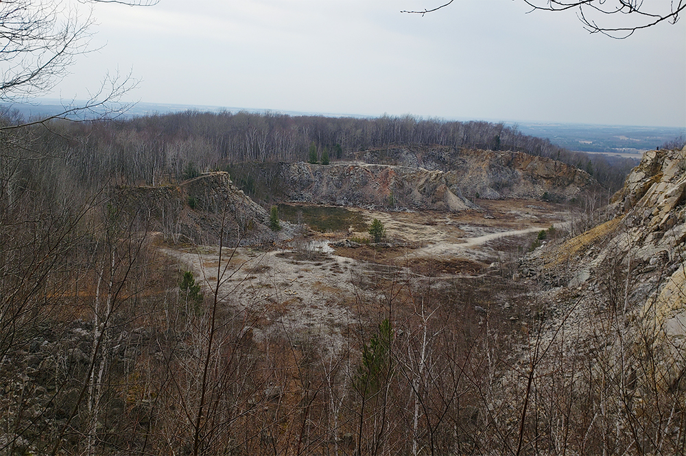
Some evidence of that glacial erosion through freezing and thawing can be seen from the south lookout tower at Rib Mountain in the form of boulders stretching down the mountainside, Montgomery said.
Despite some breakage, Rib Mountain’s quartzite is far tougher than the igneous rock, granite, that made Wausau famous and for which Rib Mountain’s ski hill was named. But chemically, when it comes to strength, there’s a clear winner between granite and quartzite.
“Granite will never win a competition against it,” Montgomery said.
I went and flew the drone over Rib Mountain in the summer, fall, winter and spring so I could make this video for y’all. pic.twitter.com/dJbJHhLH0S
— Rob Mentzer (@robertmentzer) May 12, 2021
Other Interesting Facts
- Timm’s Hill, in Price County, is the highest point above sea level in Wisconsin at 1,953 feet, but the hill itself is only about 150 feet above the surrounding landscape.
- Mosinee Hill is 1.5 miles south-southeast of Rib Mountain. It has two peaks, one 1,610 feet above sea level and the other 1,472 feet above sea level. Hardwood Hill is 3.5 miles southwest of Rib Mountain. It’s 300 feet above local elevation.
- The Rib Mountain we hike and ski on was fully exposed sometime in the past 300 million years.
- Evidence of syenite can be seen at the bottom of Rib Mountain and some can be found on the south side of Highway N, just west of where it intersects with Highway KK.
- It’s not clear to geologists why the syenite was formed, but it likely had to do with movement, pressure and heat in the mantle that forced the magma into the magma chambers underneath the volcanoes.
- During the past 2 million years, the environment alternated between periods when the landscape was similar to what it is now and being covered by glaciers.
- The earth needs cool summers and less carbon dioxide in the atmosphere to form glaciers. Cooler summers mean snow won’t melt and will form glacial ice under its own weight. If there’s too much carbon dioxide in the atmosphere, it’ll keep the earth too warm to form glaciers.
- There is no granite on Rib Mountain. The fact that the ski hill on the mountain has been renamed Granite Peak honors Wausau’s abundant granite.
- Granite is an igneous rock. Wausau’s red, gray and rotten granite rocks are a result of different minerals from other rocks that magma picked up on its way out of the volcano.
This story came from an audience question as part of the WHYsconsin project. Submit your question below or at wpr.org/WHYsconsin and we might answer it in a future story.


